Trails & Routes
Reading a hillside: what vegetation tells you about ground
Plant communities are a map of drainage, and reading them saves hours of walking through bog.
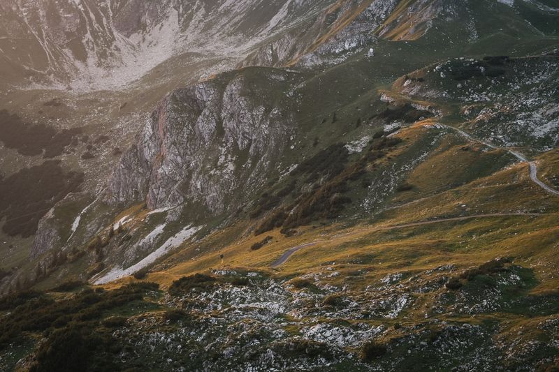
There is a short answer about reading terrain and a useful one, and they are not the same. What follows is the useful one.
The short version
- Rushes and sphagnum indicate saturated ground; heather and bilberry indicate drier.
- Bright green in an upland landscape usually means wet.
- Route choice by vegetation is often faster than route choice by contour.
Plants indicate water
Vegetation reflects drainage closely, because saturation determines what can grow. Soft rush, cotton grass, bog asphodel and sphagnum moss all indicate ground that will not carry weight well. Heather, bilberry, bracken and short grass generally indicate drier, firmer footing.
The signal is drainage rather than firmness, which is why heather growing on deep peat can still be soft underfoot, and the surest reading combines the plant with the shape of the ground it is standing on.
Colour is visible at distance
The bright, almost luminous green of sphagnum and rush is distinguishable from a considerable distance. Duller olive and brown tones usually mean drier ground. Choosing a line across a hillside by colour is a skill that develops quickly once you know to look.
Season and light shift the palette, since winter turns the same rush beds a pale straw and low sun flattens the differences entirely, so the technique is at its most reliable in the growing season under flat overcast light.
Contours do not tell the whole story
A flat area on a map may be a col carrying every drop of water off two slopes. A slightly steeper line is frequently faster because it drains.
Combining the map with what you can see of the vegetation is what experienced walkers are doing when they appear to guess well. Contour spacing also tells you whether a slope is convex or concave, which matters on the ground because a convex slope hides everything below where you are standing and is exactly where people commit to a line whose end they cannot see.
Bracken and its problems
Dense bracken conceals holes, boulders and old walls, and hides ticks effectively. It is generally an indicator of deep, well-drained soil, which is useful information and unhelpful to walk through.
Skirting a bracken slope is almost always faster than crossing it. Bracken is seasonal in a way heather is not, so a slope that is a thigh-deep obstacle in August is a flattened brown mat in March, and a route judged from a summer photograph can mislead in either direction.
Ground that has been drained
Parallel ditches across a hillside indicate historic drainage for forestry or grazing. They are hard to cross, often invisible under vegetation, and are a common cause of twisted ankles.
Where they appear on aerial imagery, they are worth routing around at the planning stage. Recently felled plantation is the worst version of this, because it combines old plough furrows with brash, stumps and no through line at all, and it is the ground most likely to appear on a map as open and walkable.
Aspect changes the ground as much as height does
A slope facing away from the sun — north-facing in the northern hemisphere, south-facing below the equator — receives far less direct radiation, so it dries later, holds old snow longer and carries a wetter plant community than the slope opposite. That shows in the vegetation long before it shows on a map: the same altitude can carry dry heather on one side of a ridge and rush and sphagnum on the other. For route choice it means the way up and the way down the same hill can be in different conditions on the same day, which is how parties find frozen ground on the ascent and calf-deep mud coming back.
Locally, it also predicts where late snow patches survive, which matters both as a water source in dry weather and as the unexpected steep snow that catches people out in early summer.
The takeaway
Walk toward the dull colours. The bright green will cost you an hour.
Go slowly enough to notice, and most of this stops being advice and starts being obvious.
Questions readers ask
Is the bright green really always wet?
In upland Britain and similar landscapes, reliably enough to plan around. It is sphagnum and rush, both of which need saturation.
How do I find a dry line across a bog?
Follow the slightly higher ground, look for heather and firm tussocks, and accept a longer distance. Straight lines across saturated ground are almost always slower.
Also by Imogen Vasse
- Crofting, commons and the land nobody quite ownsPeople & Place
- Walking in heat is a different sport, and the rules are strictTrails & Routes
- Blisters are a friction problem, not a toughness problemTrails & Routes
- Wild camping law varies enormously, and assumptions travel badlyTrails & Routes