People & Place
Place names are the oldest surviving record of a landscape
Before anyone drew a map, people named the ground for what it did. Those names are still on the map, describing conditions that may no longer exist.

The theory of place names is well covered elsewhere. This is about the version you meet in practice.
What holds up in practice
- Many names describe function, vegetation or hazard rather than commemorating a person.
- Repeated elements across a region are usually generic words in an older language.
- Names can preserve conditions that have since changed, including lost woodland and drained wetland.
Names are descriptions before they are labels
Most old settlement and landform names began as descriptions, telling a listener what kind of place this was and what could be expected there. They record vegetation, soil, water, aspect, shape and use, which is exactly the information anyone moving through a landscape on foot needed. Because the naming was practical, the same descriptive elements recur across whole regions wherever the same conditions occurred.
That repetition is the key to reading them, since a component appearing on twenty hills is a generic term rather than a name in the modern sense. Once the generic elements are recognised, a map begins to read as a description of terrain rather than as a list of arbitrary words.
Layers of language on one sheet
Most European landscapes carry names from several languages, deposited by successive populations and each surviving in different types of feature. A common pattern is that large natural features keep the oldest names, while settlements and fields carry later ones, because rivers outlast villages. Names also get borrowed without being understood, which produces the frequent case of a word meaning hill followed by a later word also meaning hill.
On the ground, those doubled names are strong evidence that one population adopted a name from another without knowing what it meant. Reading the layers requires local scholarship rather than guesswork, and reliable place-name studies exist for many regions and are worth consulting.
What names tell you about the ground
Elements referring to marsh, bog, ford, moss or wet ground indicate conditions that mattered enough to warn about, and often still matter. Names describing woodland types survive in places that have been open ground for a very long time, recording clearance that no map documented. Words for shieling, summer pasture and stock enclosure mark seasonal use patterns that shaped the landscape long after the practice ended.
Locally, names referring to boundaries, meeting points and assembly places record administrative geography that predates any written record of it. A walker who reads these is getting land-use history for free, in a form that has survived far better than most documents.
Where the reading goes wrong
Folk etymology is common and appealing, and a name that sounds like a modern word usually is not derived from it. Spellings were fixed by surveyors and clerks who were often writing an unfamiliar language by ear, which introduced errors that are now official. The same element can have different origins in different regions, so a confident interpretation transplanted from elsewhere is frequently wrong.
Names can also be transferred, invented for estates or created by tourism, and these are not always distinguishable from old ones on the map.
Anyone interested should use published place-name research for the specific area rather than a general dictionary of elements.
Names and who gets to give them
Naming is an act of authority, and the replacement of local names by administrative or colonial ones has happened across much of the world. Restoring indigenous and minority-language names on official maps has been pursued in several countries, and it is contested in some of them. Arguments concern practicality, signage costs, safety in emergencies and, more fundamentally, whose account of a place is the official one.
Where dual naming has been adopted, it has generally proved workable, and disputes have tended to centre on process rather than principle. This is a live political question in many regions, and describing it fairly means acknowledging that reasonable people disagree about implementation.
That varies by region, and it is worth checking locally.
Using them on the ground
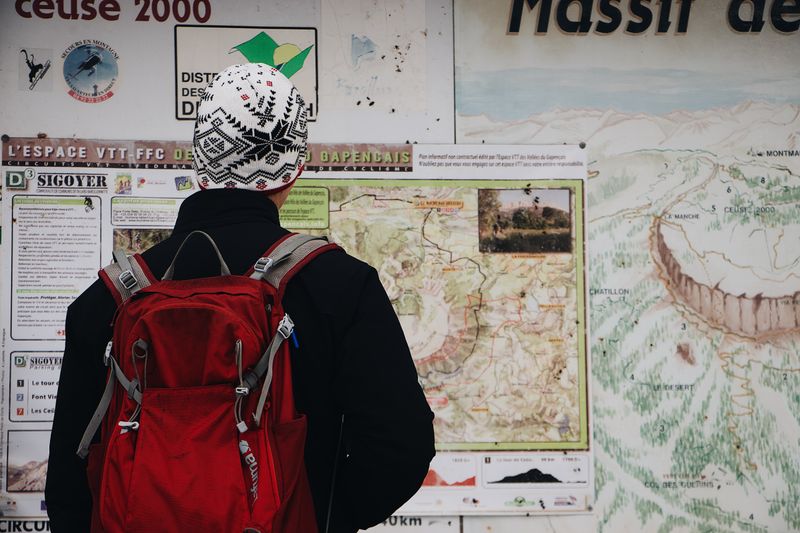
A name warning of wet ground is worth taking seriously, because it was applied by people who crossed that ground far more often than you will. Names describing steepness, exposure or difficulty likewise encode local experience that a contour interval may not capture. Pronunciation matters when asking directions, and making an honest attempt at a local name is usually received far better than avoiding it.
On the ground, local museums, heritage centres and published surveys are where the reliable interpretations live, and they are frequently more interesting than the summary version. Learning ten generic elements before visiting a region changes how legible its map is, and it takes an evening.
The takeaway
The map is already annotated. Learn the generic words and the landscape starts describing itself.
Go slowly enough to notice, and most of this stops being advice and starts being obvious.
Questions readers ask
Why do some hills have names that mean hill twice?
Because an incoming population adopted an existing name without understanding it, then added their own generic word. The doubling is evidence of language contact.
Can place names prove what a landscape used to look like?
They are evidence rather than proof. Names referring to woodland or marsh on now-open or drained ground suggest earlier conditions, and should be read alongside other sources.
Where can I find reliable interpretations?
Published place-name surveys for the specific region, and local heritage organisations. General element dictionaries are a poor guide because the same element varies by area.